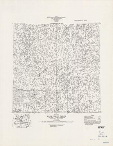
Fort Smith Sheet, District of Mackenzie, Northwest Territories
In stock
Produced by the Surveys and Mapping Branch for the Department of Mines and Technical Surveys, Canada, this topographic map gives great detail of land elevations and terrain of a given area in Canada. Indications represent portage, esker, streams, rapids, lakes, marshes, sand, and rock. This map focuses on Fort Smith in the district of Mackenzie, northwest territory. There is a library stamp and small markings on the margin.
Size: 17.25 x 17.5 inches
Condition: Very Good
Map Maker: Surveys and Mapping Branch - Canada
Coloring: Black and White
Year: 1938
Condition: Very Good
Map Maker: Surveys and Mapping Branch - Canada
Coloring: Black and White
Year: 1938
In stock


