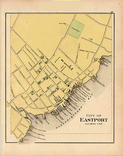
City of Eastport
In stock
This hand colored map is from Stuarts Atlas of the State of Maine made in 1890 by J. H. Stuart & Co. The city maps include great detail of the area; including the names of important land owners or businesses, landmarks, rivers, lakes, railroads and street names. Ciy of Eastport is illustrated on this well preserved map. Pastel coloring and nicely aged paper make these hard to find Maine county maps great editions to the collections of residents interested in their local history.
Size: 15.25 x 15.25 inches
Condition: Very Good
Map Maker: J. H. STUART
Coloring: Original Hand Color
Year: 1890
Condition: Very Good
Map Maker: J. H. STUART
Coloring: Original Hand Color
Year: 1890
In stock


