 |
||
Davis South Shoal and Other Dangers – Nantucket’
Out of stock
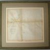
This antique coastal survey of Nantucket area was made for the United States Coast Survey in 1853. The surveys provide depth readings and notes on important coastal characteristics of the area mapped. The names of harbors, rivers, islands, channels, shoals, capes, inlets, and coastal towns are identified on the map. These charts show areas that have likely undergone significant changes due to modifications and recessions of coastal lands, making them fascinating to anyone interested in local geography and history. This map of Nantucket is framed in a rustic wood frame, with a ochre colored outer mat and a tan inner mat. On the outer mat, there are several different french lines in different colors, as well as a line of marble paper. This is a beautiful, simple yet elegant framed map for anyone that loves Nantucket! It would go perfectly in any Cape Cod cottage.
Condition: Good, slight foxing in folds
Map Maker: U.S. Coast Survey Office
Coloring: Hand Colored
Year: 1853
Out of stock