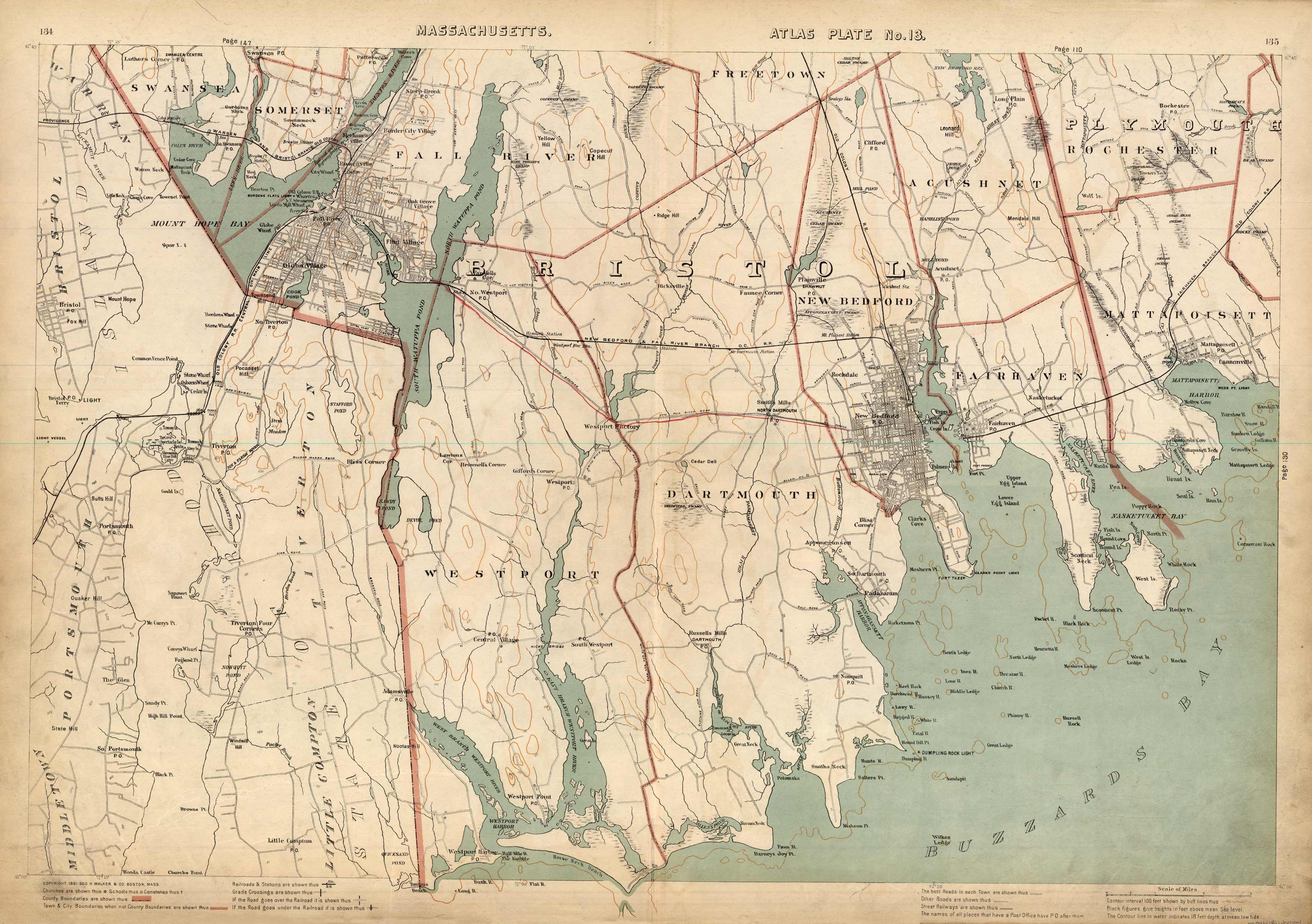
Massachusetts. Atlas Plate No. 13.
Out of stock
This 1891 map of Boston shows Swansea, Somerset, Fall River, Freetown, Acushnet, Rochester, Mattapoisett, New Bedford, Fairhaven, Dartmouth, and Westport. It labels schools, cemeteries, churches, railroad lines, light houses, ferry lines, and numerous ponds, rivers, and islands. Some nautical detail is provided; the map shows heights in feet above sea level.
Size: 26.5 x 17.5 inches
Condition: Very Good
Map Maker: Geo H. Walker & CO.
Coloring: Printed Color
Year: 1891
Condition: Very Good
Map Maker: Geo H. Walker & CO.
Coloring: Printed Color
Year: 1891
Out of stock


