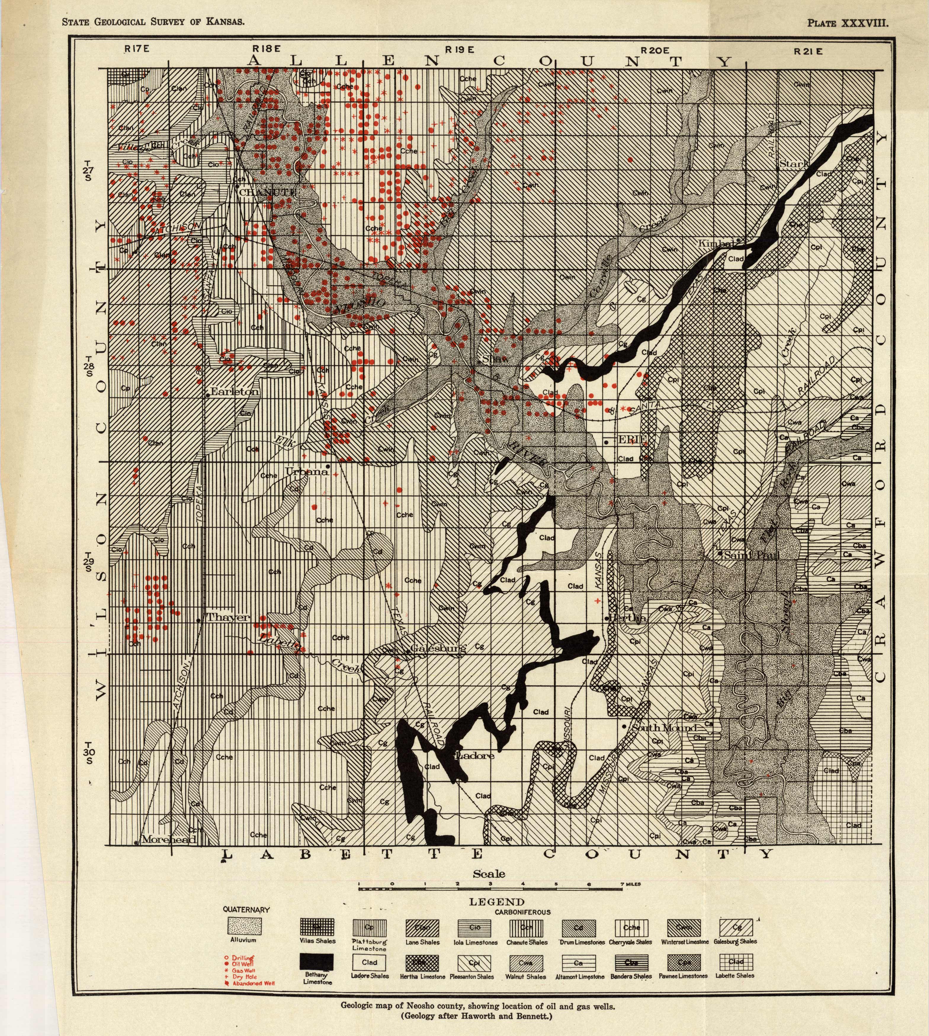
Geologic Map of Neosho County(Kansas), Showing Location of Oil and Gas Wells
Out of stock
Produced by the State Geological Survey of Kansas, this geological map shows the location of oil and gas well in Neosho county. This map indicates oil, gas, drilling, dry and abandoned well areas. The key denotes shale, flint, limestone, and other geological formations of the area.
Size: 12 x 14 inches
Condition: Very Good, light age toning
Map Maker: State Geological Survey - Kansas
Coloring: Printed Color
Year: circa 1955
Condition: Very Good, light age toning
Map Maker: State Geological Survey - Kansas
Coloring: Printed Color
Year: circa 1955
Out of stock


