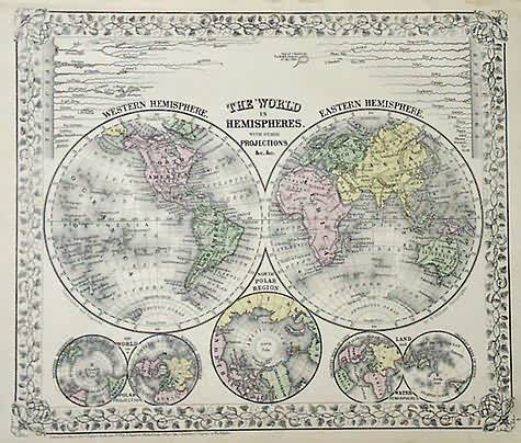
The World in Hemispheres with other Projections
In stock
A beautiful map of the world made by S. Augustus Mitchell in 1872. Illustrated in hemispheres, we also get views of the world on the Polar projection, the North Polar Region and Land and Water hemispheres, wherein the greatest mass of water and the greatest mass of land is illustrated. Rivers and great lakes are illustrated as well. A very nice map, with the distinctive Mitchell ‘ inch ivy style border
Size: 13 x 11 inches
Condition: Very Good
Map Maker: S. Augustus Mitchell
Coloring: Original Hand Coloring
Year: 1872
Condition: Very Good
Map Maker: S. Augustus Mitchell
Coloring: Original Hand Coloring
Year: 1872
In stock


