Johnsons Africa
In stock
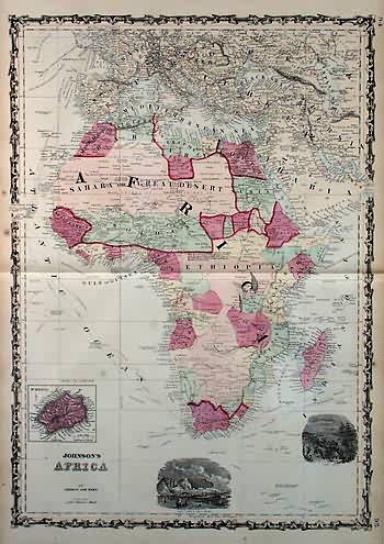
This antique map came from Johnsons New Illustrated (Steel Plate) Family Atlas, published in 1863, by Johnson and Ward. These maps are some of the most colorful andaccurate maps produced in the 1860’s. Johnson maps are characterized by hand coloring in red and green and distinctive borders, including iron scrollwork and a Celticdesign. This double page country map of Africa includes depictions of Cape Town and Table Mount, and Port Natal, with an inset of St. Helena. This map shows the exploration routes around Africa and much of central and northern Africa was yet to be explored in detail.
Size: 17 x 24 inches
Condition: Very Good-age toning
Map Maker: Johnson and Ward
Coloring: Original Hand Coloring
Year: 1863
Condition: Very Good-age toning
Map Maker: Johnson and Ward
Coloring: Original Hand Coloring
Year: 1863
In stock


