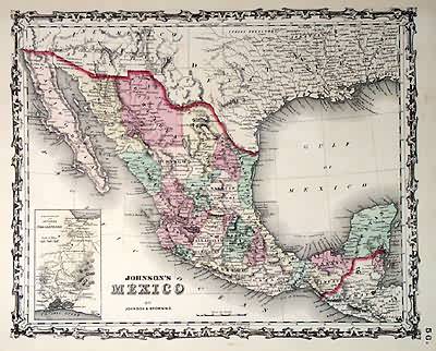
Johnsons Mexico’
In stock
This colorful map came from Johnson’s New Illustrated (steel plate) Family Atlas. Includes the the characteristic iron scrollwork decorative border. Shows railroads, common roads, canals, townships, and villages. This map is in great condition, and would look nice framed! Also has an inset map of “Territory and Isthmus of Tehuantepec”.
Size: 15.5 x 12.5 inches
Condition: Very Good
Map Maker: Johnson & Browning
Coloring: Original Hand Color
Year: 1861
Condition: Very Good
Map Maker: Johnson & Browning
Coloring: Original Hand Color
Year: 1861
In stock


