'") |
||
LIsle De La Jamaique ( JAMAICA)’
Out of stock
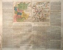
This unique and rare map of Jamaica was made by the French mapmaker Lattre in 1779. Original hand outline coloring in muted greens, reds and bright yellow highlight the geographical regions of Jamaica with two inset maps of Port Royal and Kingston and the Port of Bluefields. Topographical features are depicted with great detail given to mountains, and rivers. Place names, and transportation routes are noted and a description of Jamaica paragraph ( written in French ) is included as well. A great map, very hard to come by, Art Source International is pleased to be able to offer this island map.
Condition: Very Good
Map Maker: Lattre
Coloring: original hand coloring
Year: 1779
Map Maker: Lattre
Coloring: original hand coloring
Year: 1779
Out of stock