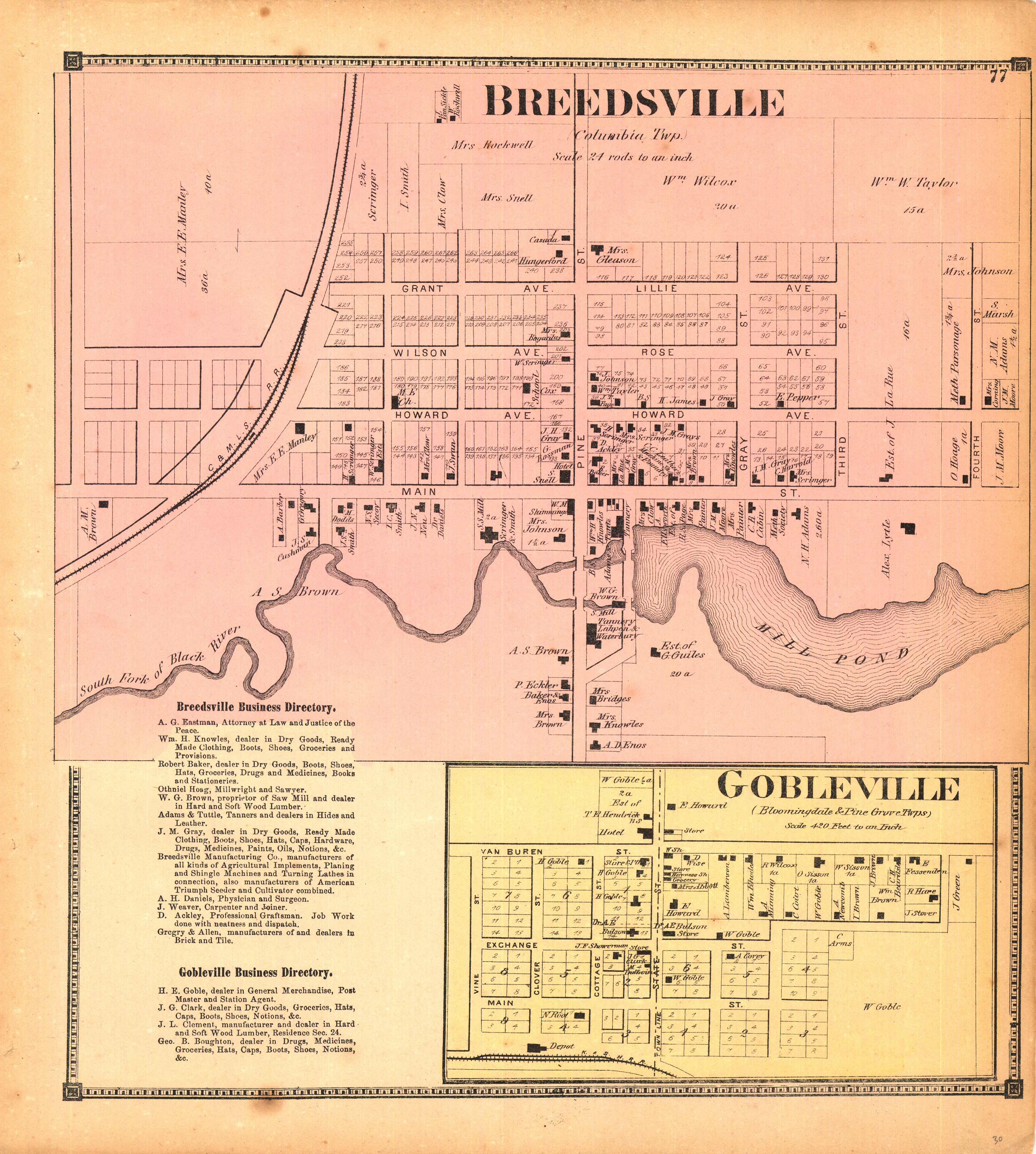
Breedsville and Gobleville (Michigan)
In stock
We are proud to offer these maps and views from the “Atlas of Van Buren Co., Michigan” – produced in 1873 from actual surveys by and under the direction of D.J. Lake, C.E., and published by C.O. Titus, Philadelphia. Property owners, important buildings and parks are shown in great detail. The names of counties, townships and towns, illustrations of railroads, rivers, creeks, lakes, and streets are also featured on this map.
Size: 12.5 x 13.75 inches
Condition: Very Good
Map Maker: D.J. Lake, C.E.
Coloring: Original Hand Color
Year: 1873
Condition: Very Good
Map Maker: D.J. Lake, C.E.
Coloring: Original Hand Color
Year: 1873
In stock


