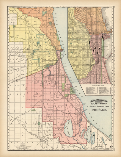
Railway Terminal Map of Chicago
In stock
This map comes from Rand, McNally & Co.s Atlas of the World, produced in 1894. Each, very detailed map, has light pastel coloring and identifies street names, cemeteries, parks, railroads, rivers, and ponds. This railway terminal map of Chicago uniquely features an excellent layout of the city’s appearance at the turn of the century. Located in the top right corner of the map is an inset of the Outer Harbor with an index to railroads. These large format maps look great framed.
Size: 19 x 26 inches
Condition: Excellent
Map Maker: Rand, McNally & Co.
Coloring: Printed color
Year: 1894
Condition: Excellent
Map Maker: Rand, McNally & Co.
Coloring: Printed color
Year: 1894
In stock


