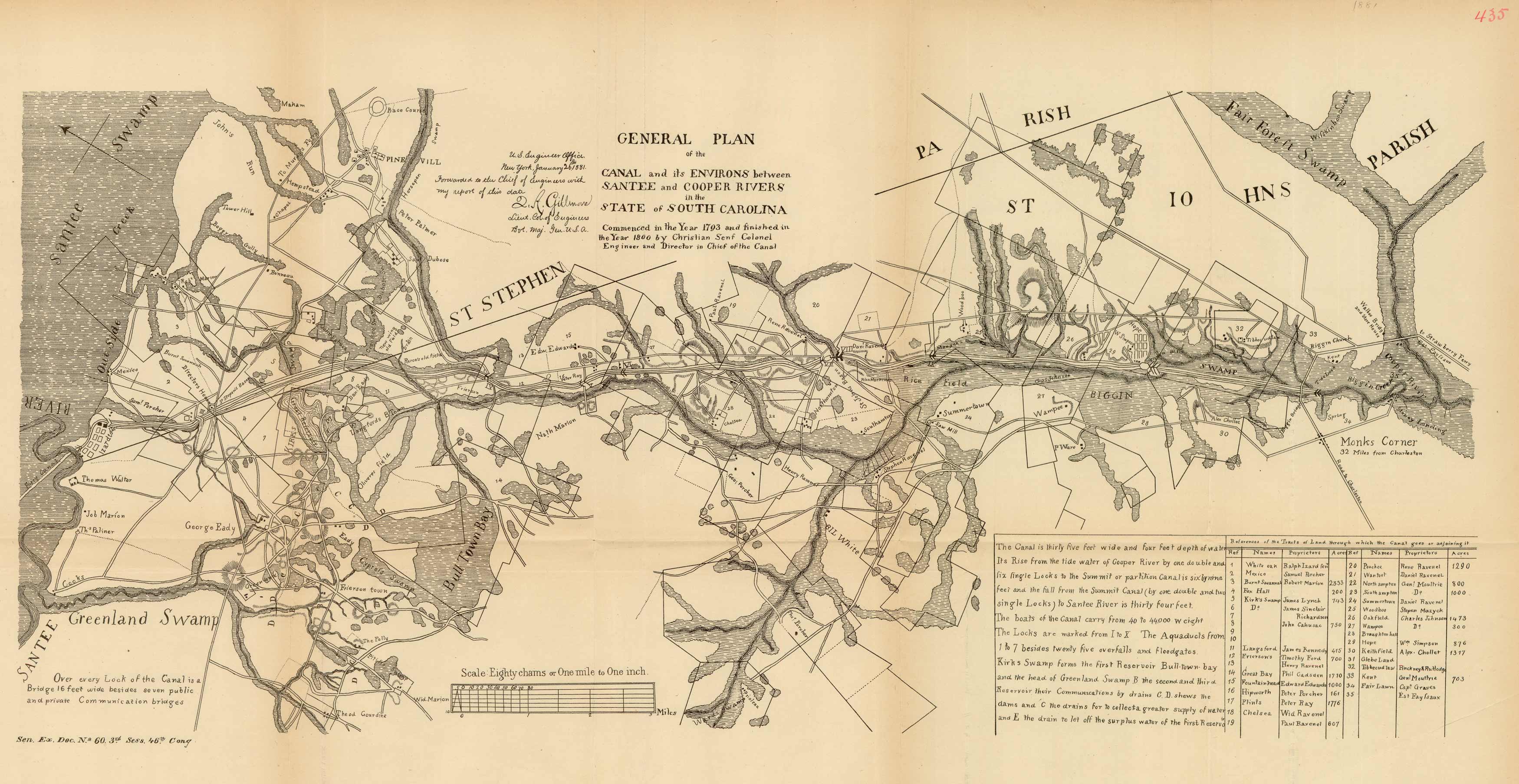
General Plan of the Canal and its Environs between Santee and Copper Rivers in the State of South Carolina
Out of stock
This map was part of an 1881 Senate Document on the Santee Canal. This map is a “general plan” of the canal (between the Santee and Copper Rivers in South Carolina). The map also has a chart with “references of the tracts of land through which the canal goes or adjoining it”.
Size: 23 x 10.5 inches
Condition: Good - paper separation and loss along folds
Map Maker: U.S. Government
Coloring: Black & White
Year: 1881
Condition: Good - paper separation and loss along folds
Map Maker: U.S. Government
Coloring: Black & White
Year: 1881
Out of stock


