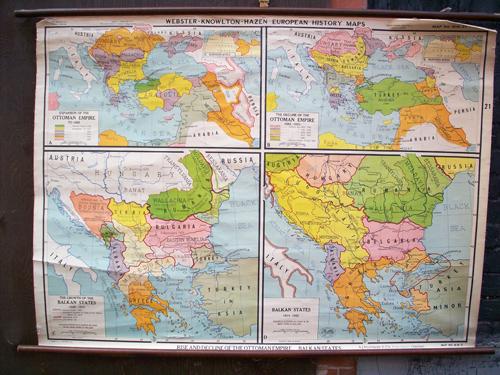
Rise and Decline of the Ottoman Empire, Balkan States
In stock
This 4-part wall map was published by A.J. Nystrom & Co as part of the Webster-Knowlton-Hazen European History Map series. This map was most likely published in 1950s-70s. Map A: Expansion of the Ottoman Empire to 1683 with an inset of Northern Africa. Colors indicate occupation starting from 1359-1683. Map B: The Decline of the Ottoman Empire 1683-1920. Colors indicate dates territories were lost. Inset of Northern Africa. Map C: The Growth of the Balkan States 1829-1913, showing boundaries proposed by treaty of San Stefano, March 3rd, 1878, Boundaries 1914, Enos-Midia Line. Map D: Balkan States, 1914-1925. Acquisitions of territory are shown by the lighter shades of each color. This map is hung on wooden dowels and is in good condition with light cracking and is separating from dowel at top. Additional pictures available. Appx size: 34″ x 46.5″ with dowels: 37″ x 48.5″
Condition: Very Good, minor cracking
Map Maker: A.J. Nystrom and Company
Coloring: Printed Color
Year: circa 1960
In stock


