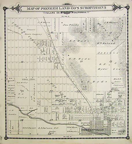
Map of Pioneer Land Cos Subdivisions – Porterville’
Out of stock
We are proud to offer the maps by Thos. H. Thompson in his rare Official Atlas of Tulare County, California. The maps show all the landowners, towns, villages, Indian Reservations and irrigation ditches. This is a map of Pioneer Land Co’s Subdivisions,also shown is Porterville and the Stockton & Tulare RR route.
Size: 12.5 x 14 inches
Condition: Good - Age toning, slight water staining in margin, small tear topright
Map Maker: Thos. H. Thompson
Coloring: Black and White
Year: 1892
Condition: Good - Age toning, slight water staining in margin, small tear topright
Map Maker: Thos. H. Thompson
Coloring: Black and White
Year: 1892
Out of stock


