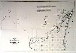
Sketch of The Public Surveys in Wisconsin Territory
In stock
Wisconsin Territory. Surveys now extending north from Wisconsin and Fox Rivers as well as south and east to Lake Michigan. Shows mills along Chippewa and St. Croix Rivers and Oneida and Brothertown Indian Reservations.
Size: 16 x 13.5 inches
Condition: Very Good, lower left margin originally trimmed close
Map Maker: General Land Office
Coloring: Black & White
Year: 1842
Condition: Very Good, lower left margin originally trimmed close
Map Maker: General Land Office
Coloring: Black & White
Year: 1842
In stock


