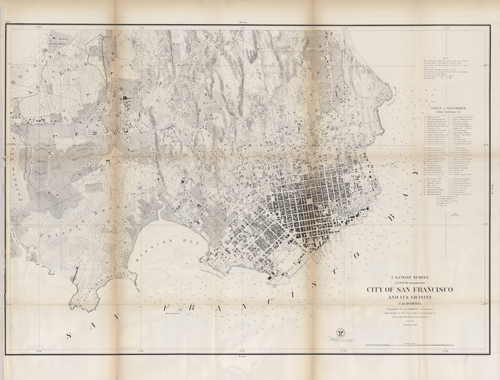
City of San Francisco and Its Vicinity California
In stock
This hand colored, antique coastal survey was made for the United States Coast Survey. This extensively-detailed 1858 map of San Francisco, California shows public buildings, the Union Race Course, the Pioneer Race Course, Rancho de San Miguel, an orphan asylum, street names, wharves, hills, lagoons, valleys,rocks, and more. Relief is shown by shading and soundings. The map contains some brief notes about the area. These charts show areas that have likely undergone significant changes due to modifications and recessions of coastal lands, making them fascinating to anyone interested in local geography and history. Sold folded as issued.
Size: 34.5 x 23.5 inches
Condition: Good - archival repairs along folds
Map Maker: U.S. Coast Survey
Coloring: Black and White
Year: 1858
Condition: Good - archival repairs along folds
Map Maker: U.S. Coast Survey
Coloring: Black and White
Year: 1858
In stock


