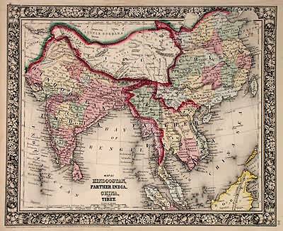
Map of Hindoostan, Farther India, China and Tibet
In stock
With characteristic floral boarders and beautiful, muted pastel coloring, these 1864 maps are fantastic examples of Mitchells work. Regions, important cities, rivers, lakes, and railroads are identified. India, China and Tibet are illustrated on this hand colored map.
Size: 13.75 x 11.25 inches
Condition: Very Good-age toning, minor foxing, water stains in margin
Map Maker: S. Augustus Mitchell
Coloring: Original Hand Color
Year: 1864
Condition: Very Good-age toning, minor foxing, water stains in margin
Map Maker: S. Augustus Mitchell
Coloring: Original Hand Color
Year: 1864
In stock


