 |
||
Palestine or the Holy Land
Out of stock
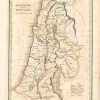
Thomas G. Bradford (1802-87) of Boston Massachusetts included this map in his first atlas entitled, A Comprehensive Atlas Geographical, Historical and Commercial. These maps were hand colored and skillfully created in 1835, which adds to their classic, decorative appeal. A sage border surrounds this map of Palestine or the Holy Land. Pink, yellow, and green are used as outline colors throughout the body of the map. The locations of the twelve tribes of Israel, mountain ranges, and bodies of water are illustrated.
Size: 7.5 x 9.5 inches
Condition: Very Good - age toning and minor foxing
Map Maker: Thomas G. Bradford
Coloring: Original Outline Hand Color
Year: 1835
Condition: Very Good - age toning and minor foxing
Map Maker: Thomas G. Bradford
Coloring: Original Outline Hand Color
Year: 1835
Out of stock