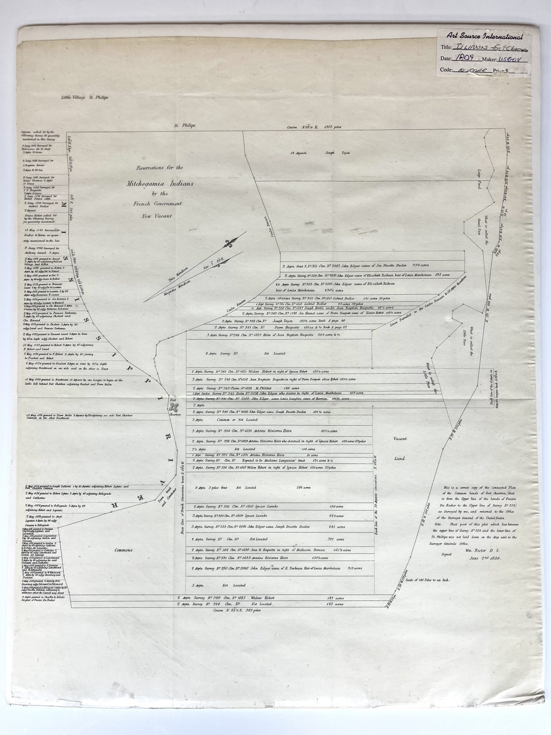
1809 Map of Fort Chartres, Illinois
In stock
Fort de Chartres was a French fortification, first built in 1720 on the east bank of Mississippi River in present-day Illinois. The Fort de Chartres name was also applied to the two successive fortifications built nearby during the 18th century in the era of French colonial control over Louisiana and the Illinois Country. Detailed description of land grants, including names, are shown throughout. Includes area labeled, “Reservations for the Mitchegamia Indians by the French Government Now Vacant.” This extremely difficult to obtain map, referred to as a “Land Ownership” map is a rare commodity. It is entitled a “Land Ownership” map because it indicates the original land owner plot number and many times their names. Created by the U.S. Government.
Condition: Very Good
Map Maker: U.S. Government
Year: 1809
In stock


