 |
||
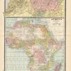
Africa/N.W Africa, Morocco, Algeria and Tunis
Out of stock
This detailed map of northwestern Africa was printed in the “Peoples Family Atlas of the World,” published in 1889. This map shows a great deal of topographical information, including lakes, mountains, and rivers.
Size: 12 x 20 inches
Condition: Very Good
Map Maker: Peoples Publishing Co.'
Coloring: Printed Color
Year: 1889
Condition: Very Good
Map Maker: Peoples Publishing Co.'
Coloring: Printed Color
Year: 1889
Out of stock