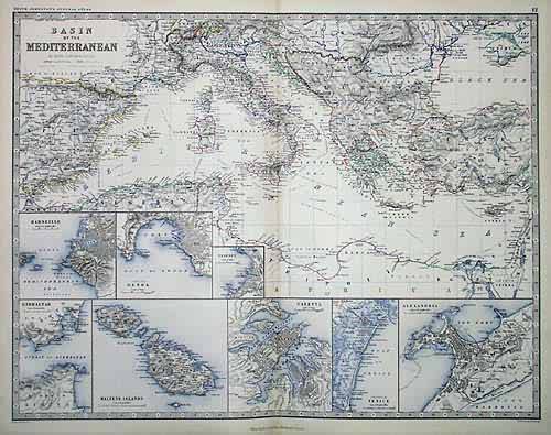
Basin of the Mediterranean
Out of stock
This large-scale map produced by Geographer to the Queen of Scotland, Alexander Keith Johnston was published in 1861 in his “Royal Atlas of Modern Geography.” Johnston apprenticed to James Kirkwood & Sons, Engravers in 1820. In 1826, he partnered with his brother William in W. & A.K. Johnston. He Died July 9th, 1871 in Yorkshire. Outlines on this map of the Mediterranean Basin are hand colored. The incredible level of detail provided is unique to this Scottish mapmaker. This map shows all topography including mountains and physical features, rivers and lakes, cities and towns, provinces and regions, and railroads. The decorative border shows latitude and longitude to the degree. Maps of Marseille, Genoa, Trieste, Gibraltar, Maltese Islands, Valetta, Venice, and Alexandria are inset.
Condition: Very Good
Map Maker: Alexander Keith Johnston
Coloring: Original Hand Outline Color
Year: 1861
Out of stock


