Canada of To-day
In stock
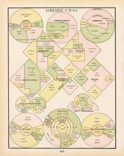
George F. Cram produced this map for his “Universal Atlas – Geographical, Astronomical and Historical,” published in 1898. In 1869 the George F. Cram Company was born and the Cram name quickly became synonymous with accuracy and innovation. This sheet shows statistical charts detailing information about Canada during this time period including Total Area and Area of the Territories, Common Schools, Commerce, Fisheries, Shipping, Debt, Religion, Mining Population, and Total Revenue and Total Expenditures. This is a great resource for studying Canada during this time period.
Size: 9.5 x 12.5 inches
Condition: Very Good
Map Maker: George F. Cram
Coloring: Printed Color
Year: 1898
Condition: Very Good
Map Maker: George F. Cram
Coloring: Printed Color
Year: 1898
In stock


