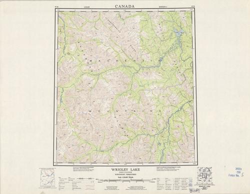
Wrigley Lake, District of Mackenzie, Northwest Territories
In stock
Produced by the Army Survey Establishment, Canada, this topographic map indicates rapids, marshes, loose roads, car trails, boundaries, contours, cliffs or low reliefs, and eskers. This is a great topographic map of the Mackenzie Mountians and nearby ranges. Colors are bright with detailed contour lines.
Size: 16.5 x 18.25 inches
Condition: Very Good
Map Maker: Army Survey, Canada
Coloring: Printed Color
Year: 1961
Condition: Very Good
Map Maker: Army Survey, Canada
Coloring: Printed Color
Year: 1961
In stock


