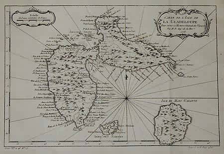
Carte De LIsle De la Guadeloupe (Carribbean Islands)’
Out of stock
Bellin was one of the most important and prolific French cartographers of the mid-eighteenth century, in the service of the French Hydrographical Office. He was responsible for an enormous output of charts and maps. This particular map is from a set of maps of the Carribbean Islands. Guadeloupe Island is illustrated, place names are labeled in French, rivers, mountains, Isles, ports, coastal points and forts are labeled clearly in a nice italic script. Bellins charts and maps were finely engraved and produced, and set the standard of accuracy, Art Source is proud to be able to offer these on our web site!
Size: 11.5 x 8 inches
Condition: Very Good- over all age toning minor tears along right side edge
Map Maker: Bellin
Coloring: Black and White
Year: 1758
Condition: Very Good- over all age toning minor tears along right side edge
Map Maker: Bellin
Coloring: Black and White
Year: 1758
Out of stock


