 |
||
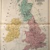
Chemins de Fer de la Gde. Bretagne (Angleterre, Ecosse et Irlande)
Out of stock
This French atlas, “Guide Geographique des Chemins de Fer” was made in 1879 by Potier. The maps illustrate proposed, begun, and established railroads; while the back of each page contains advertisements for services and products, and a guide to hotels and casinos. The British Isles are illustrated on this map. Details on the large, double page maps include the names of cities, villages, forests, lakes and rivers. The mostly black and white maps use vibrant hand color to distinguish train routes in the area.
Size: 17 x 25 inches
Condition: Very Good-age toning, minor paper loss in margin
Map Maker: Potier
Coloring: Original Hand Color
Year: 1879
Condition: Very Good-age toning, minor paper loss in margin
Map Maker: Potier
Coloring: Original Hand Color
Year: 1879
Out of stock