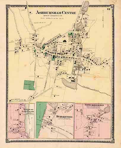
Ashburnham Centre, Naukeag or Lane Villiage, Burrageville, and North Ashburnham
In stock
This map is from the Atlas of Worcester, Massachusetts and Vicinity by F.W. Beers, and printed in 1870. Any resident of the featured area will appreciate the window into another time offered by these maps making them fantastic gifts. All maps show great detail, including the names of all property owners, public buildings, and noteworthy individuals. The maps are hand colored in bright pastels.
Size: 11 x 14 inches
Condition: Very Good - age toning, minor foxing
Map Maker: F.W. Beers
Coloring: Original Hand Color
Year: 1870
Condition: Very Good - age toning, minor foxing
Map Maker: F.W. Beers
Coloring: Original Hand Color
Year: 1870
In stock


