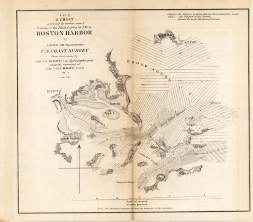
A Chart exhibiting the normal course & Velocity of the Tidal Current at Ebb in Boston Harbor
In stock
This 1848 map of Boston Harbor shows the direction of the currents and the scales of their velocities (mph) around Long Island, Nantasket Island, Deer Island, and in Boston. It extends as far north as Nahant, as far south as Petticks Island, as far east as Hull, and as far west as Boston.
Size: 8 x 9 inches
Condition: Good, tight margins
Map Maker: U.S. Engineer Office
Coloring: Black and White
Year: 1848
Condition: Good, tight margins
Map Maker: U.S. Engineer Office
Coloring: Black and White
Year: 1848
In stock


