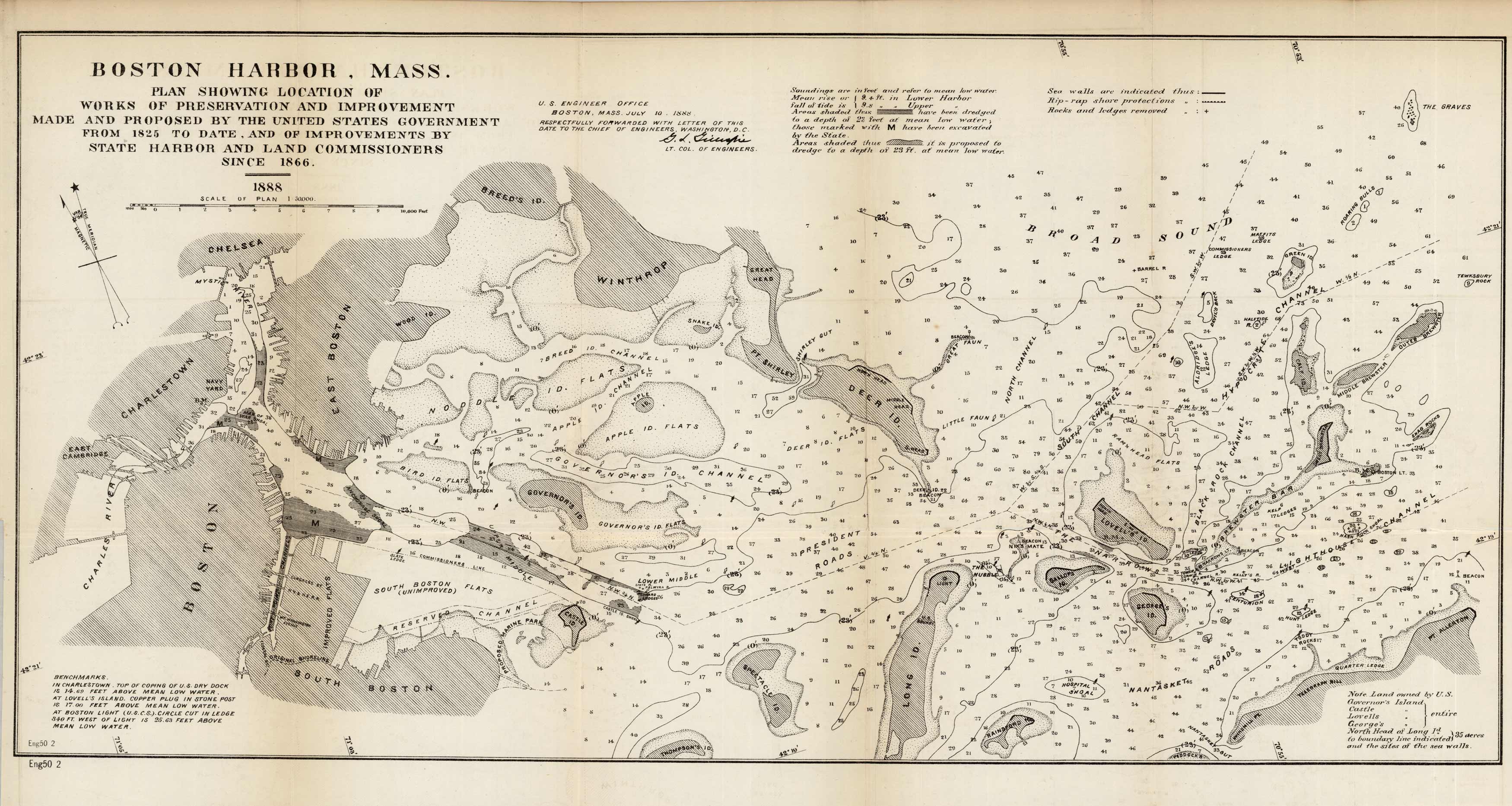
Boston Harbor Mass. Plan Showing Location of Works and Preservation and Improvement Made and Proposed by the United States Government from 1825 to date, and of Improvements by State Harbor and Land Commissioners since 1866
In stock
Issued by Corps of Engineers, 1888, this very detailed chart details the Boston Harbor, MA, showing preservation and improvements by state harbor and land commissioners. This chart reaches from East Cambridge to several of the islands out to The Graves. Proposed dredging areas are shaded, water depths and contours, shoals sea walls, rip-rap shore protections, and rocks and ledges removed are indicated. The proposed Marine Park below Castle Island is now called Pleasure Bay.
Size: 24 x 11.75 inches
Condition: Very Good
Map Maker: U.S. Corps of Engineers
Coloring: Black and White
Year: 1888
Condition: Very Good
Map Maker: U.S. Corps of Engineers
Coloring: Black and White
Year: 1888
In stock


