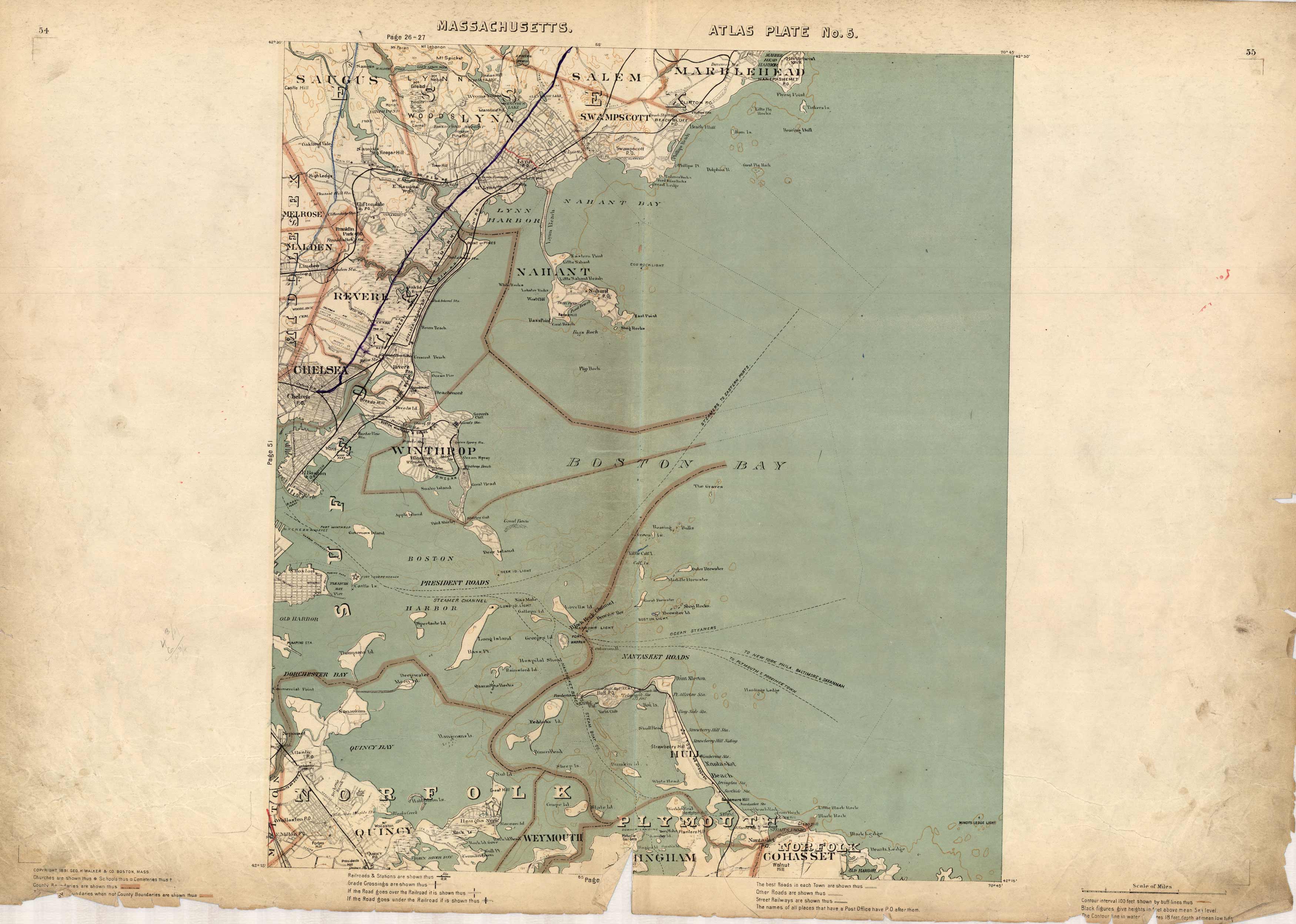
Massachusetts. Atlas Plate No. 5.
In stock
This 1891 map of the Boston Bay area captures everything from Marblehead, Salem, Lynn, Revere, Chelsea Winthrop, and down to Cohasset, Weymouth, andIngham. Points of interest shown include schools, cemeteries, railroad crossings, light houses, ferry lines, military forts, and numerous islands and reservoirs are shown. Some nautical details are provided; the map shows water depth at 18 feet depth at mean low ride and heights in feet above mean sea level.
Size: 17.5 x 15.5 inches
Condition: Good, small paper loss, some staining outside of margins, and archival repairs along folds
Map Maker: Geo H. Walker & CO.
Coloring: Printed Color
Year: 1891
Condition: Good, small paper loss, some staining outside of margins, and archival repairs along folds
Map Maker: Geo H. Walker & CO.
Coloring: Printed Color
Year: 1891
In stock


