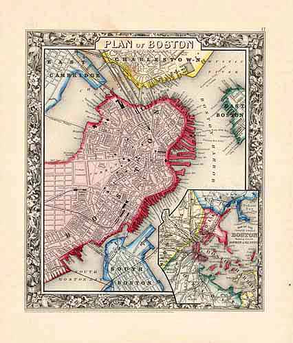
Plan of Boston
In stock
This exceptional map is from “Mitchells New General Atlas” published by S. Augustus Mitchell, Jr in 1861. This steel plate engraved map has original hand coloring and crisp engraved lines. Maps from this 1861 ( 2nd edition) atlas have become very difficult to acquire.Surrounding this map of the plan of Boston,is a ‘ inch floral border. Counties provinces, many cities,rivers and lakes are identified on this beautiful map.An inset map of the country around Boston showing also its harbor islands is included.
Size: 9.25 x 11 inches
Condition: Very Good
Map Maker: S. Augustus Mitchell
Coloring: Original Hand Color
Year: 1861
Condition: Very Good
Map Maker: S. Augustus Mitchell
Coloring: Original Hand Color
Year: 1861
In stock


