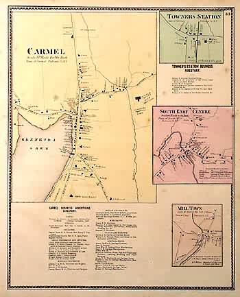
Carmel, Tower Station, SouthEast Station, Mill Town
In stock
This hand colored map is from the Atlas of New York and Vicinity by F.W. Beers, A.D. Ellis and G.G. Soule, printed in 1867. Residents of the town or county featured will value these maps of their home from a time long past, these would make a fantastic gift! Detailed street maps of the main business areas of the towns of Carmel, Mill Town, and Towners Station on this page show major businesses, streets,the Croton River, Michaels Brook,and large property owners. Each town is hand colored in a bright pastel.
Size: 12.75 x 16 inches
Condition: Good
Map Maker: F.W.Beers, A.D. Ellis, G.G.Soule
Coloring: Hand Coloring
Year: 1867
Condition: Good
Map Maker: F.W.Beers, A.D. Ellis, G.G.Soule
Coloring: Hand Coloring
Year: 1867
In stock


