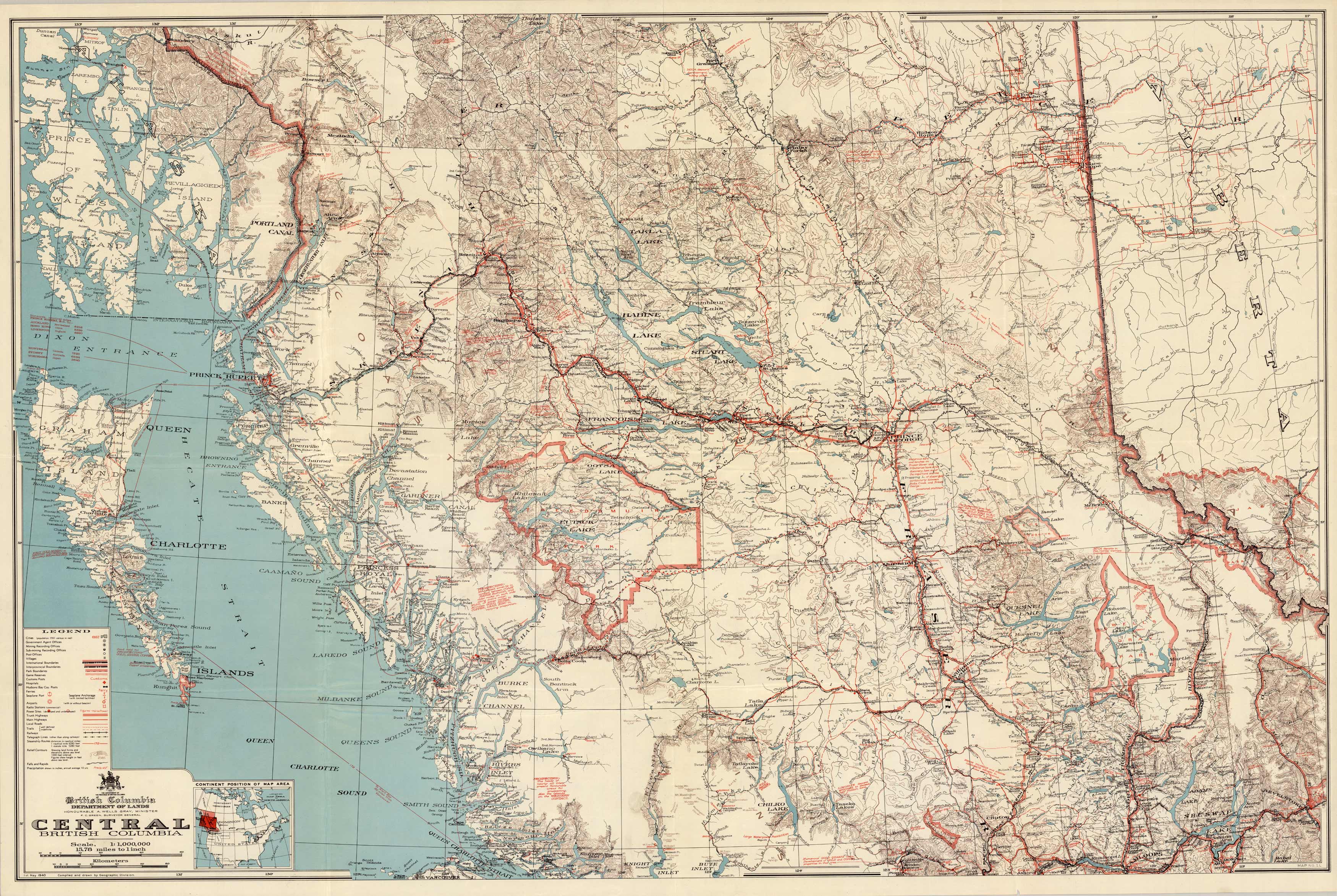
Central British Columbia
Out of stock
Produced by the Department of Lands, British Columbia this map shows the central part of British Columbia, showing Prince of Wales Island and Graham Island across Fraser River to Shuswap Lake. This map shows some topographic and land features of the area as well as some prospecting notes printed in red. Other indications on this map are government agent offices, mining recording offices, small villages or settlements, boundaries, highways, roads, railways, falls and rapids, important buildings, and more. A small inset map that shows the “Continent Position of Map Area” is at the bottom left corner for reference.
Size: 41 x 27 inches
Condition: Very Good
Map Maker: Department of Lands - British Columbia
Coloring: Printed Color
Year: 1940
Condition: Very Good
Map Maker: Department of Lands - British Columbia
Coloring: Printed Color
Year: 1940
Out of stock


