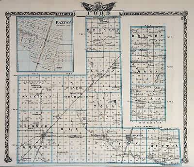
Map of Ford County
Out of stock
This hand colored map is from the Atlas of the state of Illinois by the Union Atlas Company (Warner and Beers) in 1876. Ford County is illustrated on this map.An inset is included of Paxton at a greater scale than the main map. Details include the names of towns and important land owners, and illustrations of major streets, creeks, rivers, railroads, and important buildings. The publishers note in the preface states its hope that the atlas “will be received as the most valuable and complete compendium of information, in all the various departments embraced, that has yet been published in Illinois.
Size: 15.5 x 13 inches
Condition: Very Good- light foxing, age toning
Map Maker: Union Atlas Co., Warner and Beers
Coloring: Printed Color
Year: 1876
Condition: Very Good- light foxing, age toning
Map Maker: Union Atlas Co., Warner and Beers
Coloring: Printed Color
Year: 1876
Out of stock


