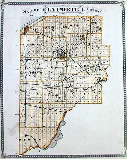
Map of LaPorte County, Indiana
In stock
This detailed county map was originally published in the “Illustrated Historical Atlas of the State of Indiana.” Published on the countrys centennial, this is a dramatic and wonderful work that was a celebration of the nation’s settlement and development. These maps epitomize the best of late 19th century American map making, as they contain great cartography, but more so have a flair for presentation that speaks so much of the aesthetic of the age. The maps have an intricate decorative border, and abound with fancy title blocks and decorative scrolling. Amazingly, these maps not only give us the roads and towns of the time, but even show us locations of homes and churches, as well as rivers and wetlands. These are unrivaled genealogical resources and wonderful decorative items. Condition is very good.
Condition: Very Good
Map Maker: Baskin & Forster
Coloring: Original Hand Coloring
Year: 1876
In stock


