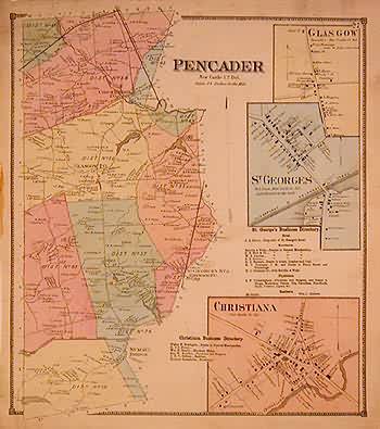
Pencader, New Castle County
Out of stock
This beautiful, hand colored map is from the “Atlas of the State of Delaware” made by D. G. Beers in 1868. Details include the names of counties, cities, townships, important property owners, geographical features and railroad lines, as well as pastel coloring to distinguish regions. Pencader in New Castle County is illustrated on this map with insets of Glascow, St. Georges, and Christiana. Lists of local buisinesses in Christiana and St. Georges are provided.
Size: 12.25 x 14.25 inches
Condition: Good-age toning, light foxing, minor paper loss on map, smudges in margin
Map Maker: D. G. Beers
Coloring: Original Hand Color
Year: 1868
Condition: Good-age toning, light foxing, minor paper loss on map, smudges in margin
Map Maker: D. G. Beers
Coloring: Original Hand Color
Year: 1868
Out of stock


