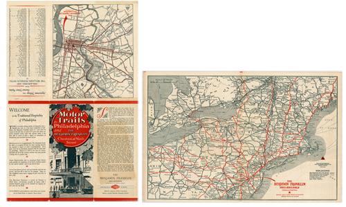
Motor Trails to Philadelphia and the Benjamin Franklin, Chesnut at Ninth Street
In stock
This pocket map of motor trails to the Philadelphia and the Benjamin Franklin hotel was published in the 1920s by The National Survey Company in Chester, VT. This pocket map folds out completely to a map of motor trails through the New England states. The inner map is a tighter section of Philadelphia and roads leading to the Benjamin Franklin hotel. There is also an index showing the approximate mileage from Philadelphia from various cities. There is also a short description of the hotel and its services.
Size: 17.5 x 11.25 inches
Condition: Very Good, with some minor foxing (on back cover)
Map Maker: The National Survey Company
Coloring: Printed Color
Year: 1920
Condition: Very Good, with some minor foxing (on back cover)
Map Maker: The National Survey Company
Coloring: Printed Color
Year: 1920
In stock


