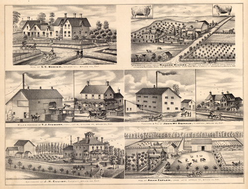
Res. of G.G. Bobier, Springhill Farm – Richard Rivers, Breeder and Dealer in Durham Cattle, Cotswold, Leicester, & Southdown Sheep; T.J. Stewart, Mills, Kinloss TP.; John McDonald, Tannery, Tiverton TP.; J.H. Elliot, Chesley and Adam Esplen, Arban TP.
In stock
This print was originally produced as part of the “Illustrated Atlas of the Dominion of Canada Containing Authentic and Complete Maps of all the Provinces, the North-West Territories and the Islands of Newfoundland.” We have never seen these maps and views in our over 35 years of map buying and selling. There are very few records of these maps selling in the last 30 years. Truly beautiful presentation.
Size: 17.5 x 14 inches
Condition: Very Good
Map Maker: H. Belden
Coloring: Black and White
Year: 1880
Condition: Very Good
Map Maker: H. Belden
Coloring: Black and White
Year: 1880
In stock


