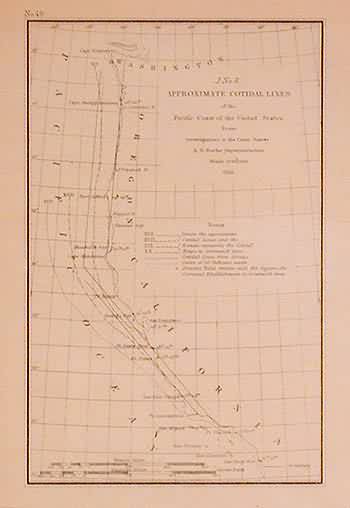
Approximate Cotidal Lines of the Pacific Coast of the United States, 1855
In stock
This black and white coastal survey was made by the U.S. Coast Survey Office in 1855. The approximate cotidal lines and the pacific coast line are illustrated on this map. The names of important cities, harbors and rivers are identified. These antique surveys show a fascinating and unique perspective of the areas illustrated. Some margins are close due to the manner in which the surveys were bound.
Size: 5 x 7.75 inches
Condition: Very Good-age toning
Map Maker: U.S. Coast Survey
Coloring: Black and White
Year: 1855
Condition: Very Good-age toning
Map Maker: U.S. Coast Survey
Coloring: Black and White
Year: 1855
In stock


