 |
||
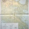
Gulf Coast of the United States, Mississippi River to the Rio Grande
Out of stock
This coastal survey was made in Washington D.C. in 1945 by the U.S. Hydrographic Office from information compiled by the U.S. Coast and Geodetic Survey. The Gulf Coast from the Mississippi River in Louisiana to the Rio Grande in Texas is illustrated on this map. Details include depth readings, lights, buoys, radio beacons ( stamped on map), and the names of important cities and waterways along the coast. The most recent corrections are hand stamped on the map. Notes on the map read: Warning: Aids to navigation may be altered, interrupted or removed without notice. In general, temporary changes due to war conditions are not incorporated on the chart. Caution: For inshore waters, wrecks and their markers are not shown on this chart. Larger scale charts should be considered for further details.
Condition: Good- water stains, on one quarter of map, other small stains and holes from pins
Map Maker: U.S. Hydrographic Office
Coloring: Machine Color
Year: 1945
Out of stock