 |
||
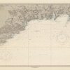
Ireland- South Coast- Eire- Wexford to Kinsale- From a British survey in 1890
Out of stock
This coastal survey, produced in 1957, shows Wexford to Kinsale, Ireland. It was printed by the U.S. Navy Hydrographic Office in Washington D.C. Details include the names of cities and waterways along the coast. Depth soundings are shown in fathoms. Other details that maybe included are lighthouses and buoy positions.
Size: 48 x 26.75 inches
Condition: Excellent, repaired tear on right side margin
Map Maker: Hydrographic Office, U.S. Navy
Coloring: Printed Color
Year: 1957
Condition: Excellent, repaired tear on right side margin
Map Maker: Hydrographic Office, U.S. Navy
Coloring: Printed Color
Year: 1957
Out of stock