 |
||
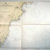
Maine and New Hampshire — Cape Elizabeth to Portsmouth
Out of stock
WWII U.S. Coast and Geodetic Survey (U.S.C. & G.S.) map. Chart #1205 Originally published at Washington D.C. Sept 1943. This map is very detailed showing land masses, roads, towns, rivers, lakes, swamps, some topographic marks, towers, harbors, ledges, beaches, rocks, points, heads, shoals, fish trap areas, prohibited areas, coves, railroads, intracoastal waterways, and depth readings all along the coast. This map would make a great gift if you live in this area or know someone who does. Has the Department of Commerce seal printed on map. Other information detailed on map: —sOUNDINGS IN FEET AT MEAN LOW WATER” —Includes details of: lights, buoys, radio beacons, Coast Guard Stations, radio towers, day beacons, storm warnings, authorities, nautical miles, and a tide level chart for different locations. —Note date originally hand stamped on outside of margin. —“Warning: Aids to navigation may be altered, interrupted or removed without notice. In general temporary changes due to war conditions are not incorporated on the chart. —This map has notes of a “Defensive Sea Area” and a “Restricted Area” —Also has notes of ‘submarine Trial Area”‘
Condition: Excellent
Map Maker: U.S. Coast and Geodetic Survey
Coloring: Color
Year: 1945
Out of stock