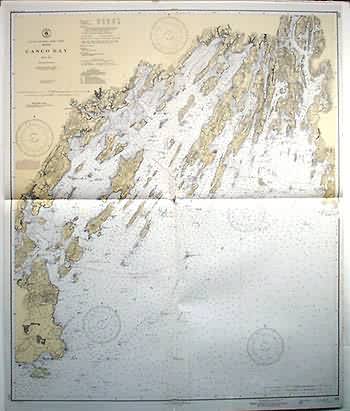
Maine- Casco Bay
Out of stock
This coastal survey was stamped as complete in Washington D.C. by the U.S. Coast and Geodetic Survey on March 3, 1945. Casco Bay and the surrounding coast and islands are illustrated on this map.Details include the names of waterways and some cities along the coast. Cable and dumping areas are stamped on the map. Notes on the map read: Caution: Temporary changes affecting Lights, Buoys and Day Beacons Aides which have been destroyed or removed, but which will be reestablished and are temporarily replaced by aids of different characteristics, are indicated in color by the following abbreviations… Warning: Aids to navigation may be altered, interrupted or removed without notice. In general, temporary changes due to war conditions are not incorporated on the chart. Defensive Sea Area: The water area on this chart is part of a defensive sea area. A vessel not proceeding under U.S. Naval or other U.S. authorized supervision shall not enter or navigate the waters of a defensive sea area., except during daylight, when good visibility conditions prevail, and then only after specific permission has been obtained.
Condition: Very Good- age toning
Map Maker: U.S. Coast and Geodetic Survey
Coloring: Machine Color
Year: 1945
Out of stock


