 |
||
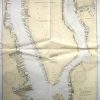
New York and New Jersey- Hudson and East Rivers
Out of stock
This coastal survey was made in Washington D.C. on March 3, 1945 by the U.S. Coast and Geodetic Survey department. The Hudson and East Rivers from West 67th St. to Blackwells Island along the New York and New Jersey coasts is illustrated on this map. Details include depth readings, beacons,cable lines, bouys, and lights (stamped on map), major roads on the coast, and important cities. Most recent corrections are stamped on map.
Size: 30.25 x 45 inches
Condition: Excellent
Map Maker: U.S.Coast and Geodetic Survey
Coloring: Machine Color
Year: 1945
Condition: Excellent
Map Maker: U.S.Coast and Geodetic Survey
Coloring: Machine Color
Year: 1945
Out of stock