 |
||
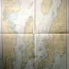
Rhode Island- Narragansett Bay Including Newport Harbor
Out of stock
This coastal survey was made in Washington D.C. in September, 1944. Narragansett Bay including Newport Harbor in Rhode Island is illustrated on this map. Details include depth readings,major roads and important cities along the coast,identification of prohibited and restricted areas where appropriate, cable areas, the locations of radio beacons, and a table to show the variation of the tide. Other Details include: Date of Issue and most recent corrections hand stamped on map Notes on the map read – WARNING: Aids to navigation may be altered, interrupted or removed without notice. In general, temporary changes due to war conditions are not incorporated in the chart. Defensive Sea Area The Waters within the indicated limits o this chart are part of a Defensive Sea Area. Unless proceeding under United States naval supervision, vessels shall not be navigated in this area except during daylight under conditions of good visibility, and then only by specific permission. Vessels opperatin
Condition: Excellent- small tear on fold
Map Maker: U.S. Coast and Geodetic Survey
Coloring: Machine Color
Year: 1944
Out of stock