- You cannot add another "Gulf of Venezuela, Peninsula de Guajira, Castilletes Anchorage and Approaches" to your cart. View cart
 |
||
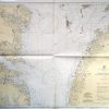
Virginia – Chesapeake Bay, Wolf Trap to Smith Point
Out of stock
This coastal survey was made in Washington D.C. in March, 1945 by the U.S. Coast and Geodetic Survey department. Chesapeake Bay from Wolf Trap to Smith Point is illustrated on this map. Details include depth readings, roads and important cities along the coast,lableing of prohibited and restricted areas where appropriate,red sectors, and a table to show the variation of the tide. A note on the map reads “WARNING: Aids to navigation may be altered, interrupted or removed without notice. In general, temporary changes due to war conditions are not incorporated in the chart. Date of Issue Hand Stamped in Border and Most Recent Corrections are Stamped on Map
Size: 38.5 x 31 inches
Condition: Excellent
Map Maker: U.S. Coast and Geodetic Survey
Coloring: Machine Color
Year: 1945
Condition: Excellent
Map Maker: U.S. Coast and Geodetic Survey
Coloring: Machine Color
Year: 1945
Out of stock