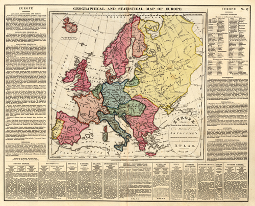
Geographical and Statistical Map of Europe
Out of stock
This highly unique map was made by C. V. Lavoisne and published by John Satchell in London 1829. This map was originally published in “Lavoisnes Complete Genealogical, Historical, Chronological, and Geographical Atlas.” Special to these maps is the fascinating description surrounding the map. This text discusses many of the following topics: boundaries, principal towns and populations, religion, trades, language, climate, soil, produce, seas, lakes, rivers, canals, mountains, government, animal populations, and more. The map itself is very detailed, showing cities and towns, lakes and rivers, common roads, mountains, and canals. A wonderful map, full of history! This map is accompanied by pages of hand colored genealogical and historical tables.
Condition: Excellent
Map Maker: C.V. Laviosne
Coloring: Original Hand Color
Year: 1829
Out of stock


