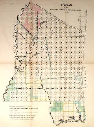
Diagram of the Surveying District South of Tennessee (Mississippi)
In stock
Attractive early GLO of Mississippi in green, yellow, and pink shaded and outline color. Shows Old Choctaw Boundary, Choctaw Cession of 1830, Choctaw boundary of 1822, Choctaw District, and the north border of the mapped area is the boundary line between the Choctaw and Chickasaw Cessions. Southern portion is divided into districts west and east of the Pearl River. Shows Vicksburg, Columbus, and Natches.
Size: 12 x 16 inches
Condition: Very Good
Map Maker: General Land Office
Coloring: Outline Color
Year: 1838
Condition: Very Good
Map Maker: General Land Office
Coloring: Outline Color
Year: 1838
In stock


