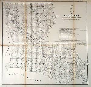
Map of Louisiana
In stock
Numerous towns and good riverine detail. Survey grid covers all of state, but uncertain areas include parts of the Sabine and Pearl Rivers, L. Chestimacha, and a section of coastline near Bayou la Fourche. Shows Houmas, Grosse Tete, Dauterive, Davenport and other claims and the rejected claim of the Baron de Bastrop. Also shows the outline of assumed extent of swamp and overflowed lands, which represent a significant portion of the state.
Size: 16 x 15.5 inches
Condition: Very Good, minor age toning on folds, and lower part of left margin originally trimmed close
Map Maker: General Land Office
Coloring: Black & White
Year: 1857
Condition: Very Good, minor age toning on folds, and lower part of left margin originally trimmed close
Map Maker: General Land Office
Coloring: Black & White
Year: 1857
In stock


