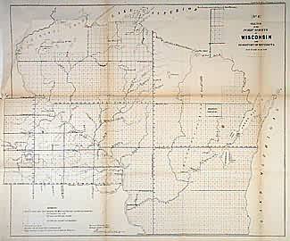
Sketch of the Public Surveys in Wisconsin and Territory of Minnesota
In stock
State of Wisconsin and Territory of Minnesota. Surveys in progress to west of Mississippi and Upper Peninsula of Michigan. “Chipeway Land”, Menominee Cession of 1848, and Oneida, Menominee, Stockbridge/Brothertown, and Winnebago reserves labelled. Settlements only along Mississippi and Minnesota Rivers, including St. Paul, Red Wing, Winona, Brownsville, Winona, Mankato, Henderson as well as Ft. Gaines and Snelling, Prairie du Chien and Dubuque.
Size: 21 x 17.5 inches
Condition: Good, age toning on folds
Map Maker: General Land Office
Coloring: Black & White
Year: 1856
Condition: Good, age toning on folds
Map Maker: General Land Office
Coloring: Black & White
Year: 1856
In stock


