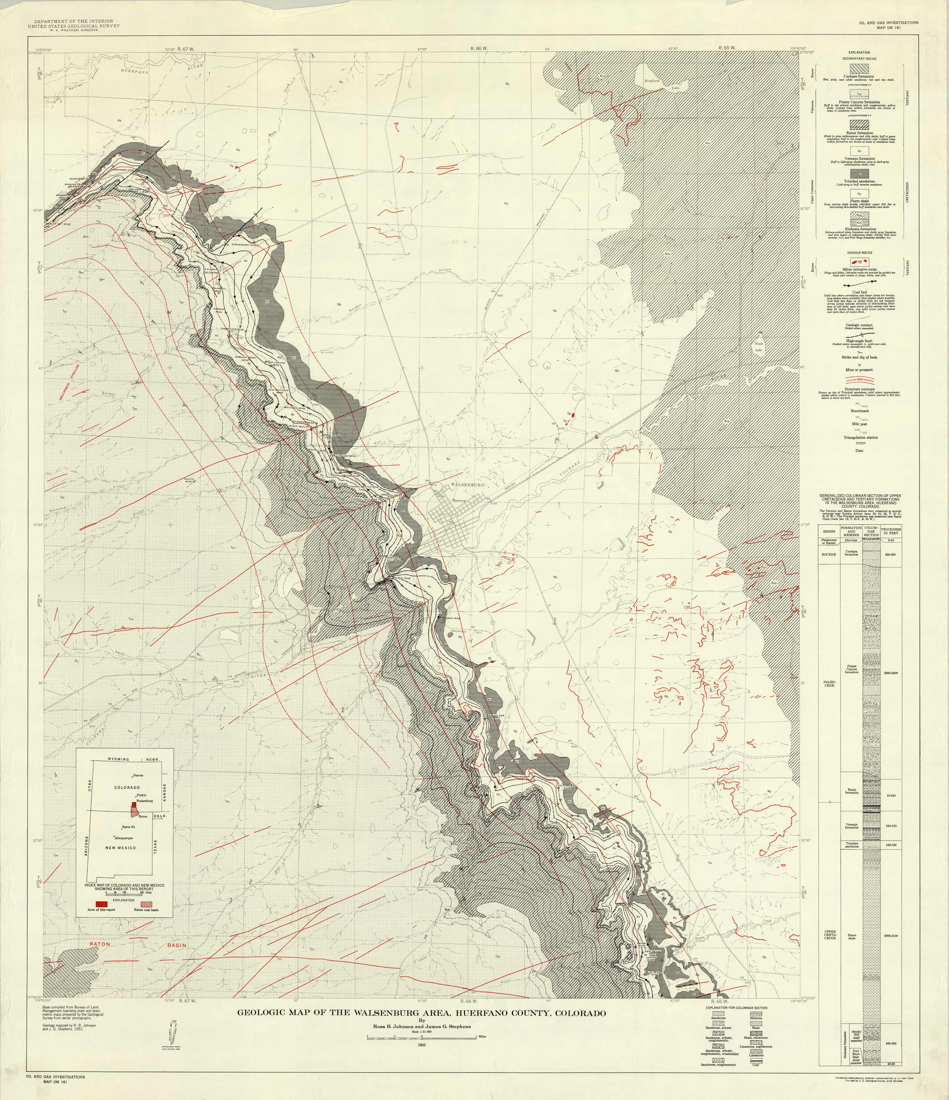
Geologic Map of the Walsenburg Area, Huerfano County, Colorado
In stock
Published in 1955 by the Department of the Interior, United States Geological Survey, this geological map of Walensburg area in Huerfano County, Colorado shows the sedimentary rock formations and mines or prospects. Details on the map include the sedimentary rocks, igneous rocks, coal beds, high angle fault, structure contours, mile post, and dams. A Generalized Columnar Section of Upper Cretaceous and Tertiary Formations in the Walsenburg area, Huerfano County, Colorado is also included, which details the formation and the thickness in feet.
Size: 32.25 x 37.5 inches
Condition: Very Good
Map Maker: United States Geological Survery
Coloring: Printed Color
Year: 1955
Condition: Very Good
Map Maker: United States Geological Survery
Coloring: Printed Color
Year: 1955
In stock


